Monday 21 May 2012

Glacial landforms (and fossils!!) in Dalarna


Thursday the 17th of May, we went on a two-day fieldtrip to Dalarna, a province in the western central Sweden. Dalarna is rather important regarding quaternary geology in Sweden, as the highest coastline – the highest sea level since the last Ice Age – ran through it. The highest coastline is an important boundary between wave-affected land below and the land above, which has no features related to coastal erosion and deposition. Therefore, the landforms can be rather different above and below this line.

I am rather ashamed, but I did not make note of every locality we visited. I was very tired, you see. However, that might just be for the better for you! Consider it that I have spared you from all sights that will not astound you.

The first – actually, the first – stop was a dried-out waterfall. It is thought to have dried out about 7000 years ago, so it would not have been active for more than a couple of thousand years, which could explain why the channel is so rough and unrounded (recall that water erodes rocks to rounder, smoother shapes). 


The most striking feature is the tilt of the rock blocks that make up the channel. I do not know what could have caused it, but it feels like tectonic forces were involved.

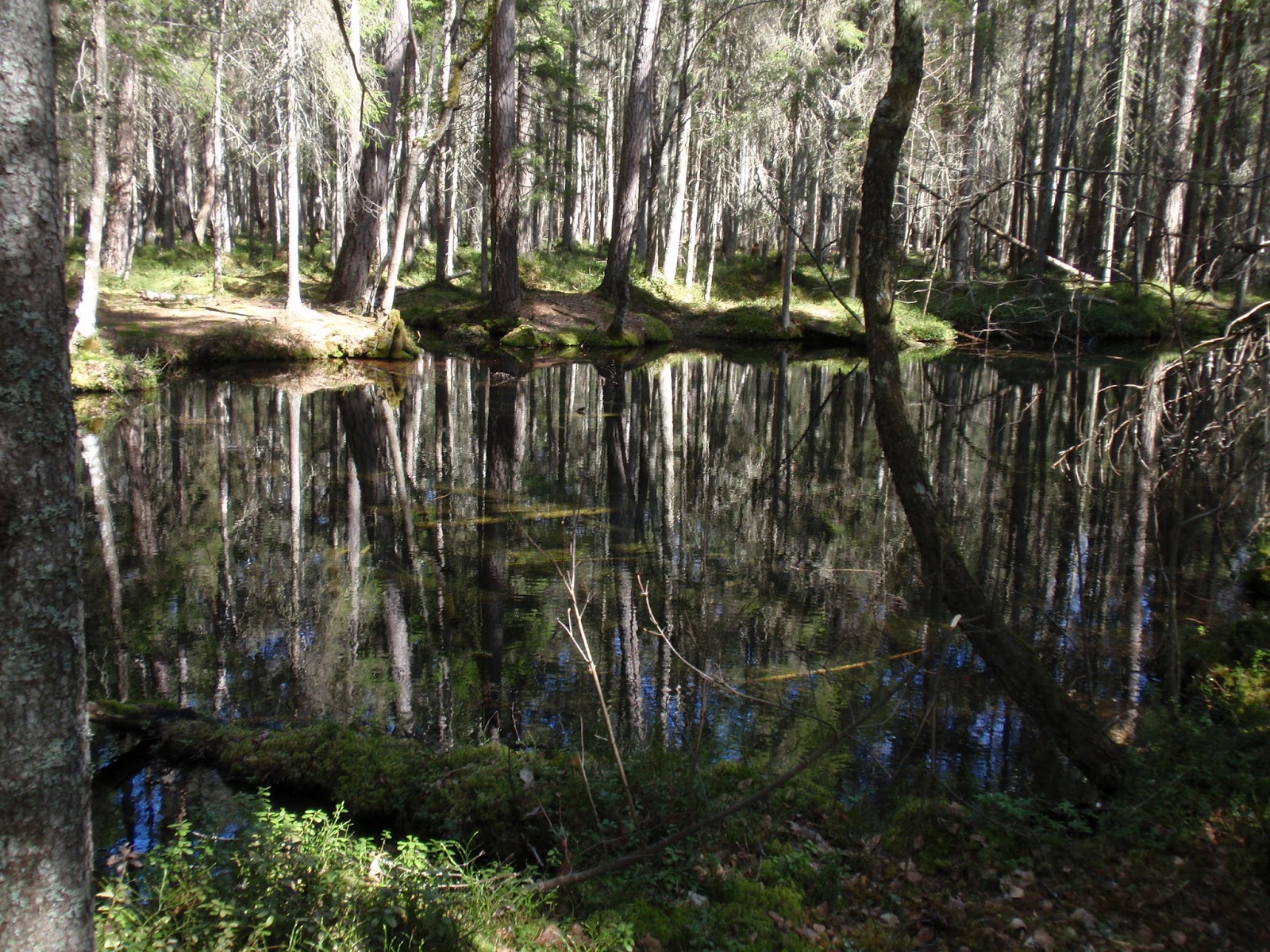
The next site of note was a forest where the highest coastline went right through. Magnus, our brilliantly pedagogical teacher, took us from the highest point in the forest and downward, so that we could see how the landscape changed in the direction the sea had receded. Not only did he point out various landforms, but also showed us several dug-out holes in the ground, where we could see how the deposited sediments changed as we went down. He was very fond of digging holes in the ground, you could tell. (Geologists…) And it was an excellent way of showing these things that seemed so vague in a textbook. Unfortunately, I am hopelessly incompetent when it comes to quaternary deposits, mostly because I cannot find anything interesting in them. They don’t tell me anything. They are just in the way, covering the nice fossils and bedrock! I guess it is just one of those things I am not naturally curious about, and, since I don’t know much about them, I don’t see anything interesting about them, and, therefore, I am not keen on learning more, since they seem boring, and so the vicious circle goes on.

However, this site was noteworthy, because, at the end, we came to a hole where the quaternary deposits had been converted into soil. Soil is basically the portion of the ground that is affected by, or supports, plant life. And plants are very much alive, and crucial for animals. Plants per se are fascinating organisms, but understanding plants also helps you understand animals. Understanding soil helps you understand plants. Any plant cannot grow in any kind of soil, so soil properties are crucial for what type of plant life it can support.

Now, I am not a soil expert, just a beginner. What we saw here was basically the most advanced thing I know about soil.


This is a typical soil profile, a real textbook example, with clear sections, called horizons. Different types of soil have different horizons, but this one is a classical profile. The soil type is called podsol (may also be spelt podzol), and is the most common in Sweden. The top layer is the O-horizon, and is basically the layer of dead, decaying organic matter (hence the O) covering the ground. Below is the A-horizon (the darker brown and black layers), where organic matter has been mixed with quaternary deposits, and thus is a blend of organic and inorganic matter. The pale grey zone is the E-horizon, where two important processes occur: eluviation (hence the E) and leaching. When rainwater percolates down through the upper soil layers, it picks up acids released during the decay of the organic material. These acids help dissolve nutrients in the E-horizon, and so the nutrients are washed away from this portion of the soil. This is leaching; eluviation is basically the same process, but about smaller, insoluble rock particles. The removal of organic nutrients bleaches this horizon, giving it its characteristic paleness. The nutrients are deposited in the lower, more alkaline portions of the soil, the B-horizon, where the acid is neutralised, thus precipitating the solutes. (Whether and why the insoluble components are deposited here as well is unknown to me.) Below the B-horizon, the C-horizon, consisting of unaltered inorganic material, stretches all the way down to the bedrock.

Now, what could be so interesting about this? Well, it makes you think about where the nutrients are located in the soil: at the top layers and somewhere in the lower half of the middle section. And this makes you wonder about the plant roots: where should they strive to go? The upper portion, or the B-horizon? And if it goes down to the B-horizon, what happens in the section of the roots that touch the E-horizon? Note that roots do not absorb nutrients from their tips, which consist mostly of hard, dead cells, used to plough down through the earth. 

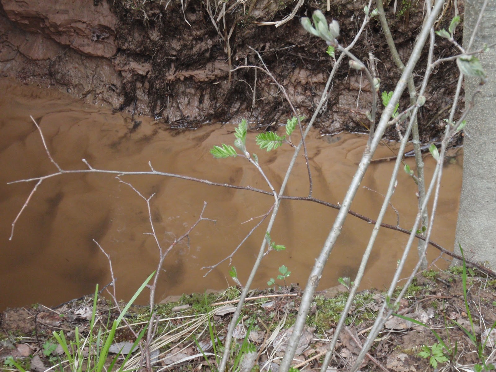
Next, we visited an old ravine, but, lamentably, it was not a rocky one, as I had pictured in my imagination. It was full of quaternary deposits, grasses, shrubs and trees, and a tranquil stream flowing through. Then, it is not difficult for you to guess which part was interesting: quaternary deposits or water.

The stream bank consists of silt – a very fine-grained sediment type, second only to clay – and is therefore very easily shaped by the currents, which easily carry such small particles around. Recall ripple marks – fossilised waves, evidence of past currents, either of wind or water – well, here we could see fresh ripples ad the bottom of the stream!


Now that I had seen ‘recent’ ripple marks, it was clearer that fossilised forms truly do represent ancient currents. As the famous phrase goes: the present is the key to the past.

However, the greatest aha-feeling came when our teacher illustrated a concept that really was hard to grasp in theory: the process of soil liquefaction – moist sediment made to flow like a liquid by strong vibrations, such as an earthquake. Our teacher took us to this exposed river bank platform.


He showed how stable this moist silt was by stepping out on it: it bore him without effort. Then he began kicking his boot fiercely on a spot, simulating an earthquake, and we could see how the silt turned more and more gooey, until it was more like a viscous fluid.


There I had seen it with my own eyes, and was completely mesmerised. This was the apex of the day.

Well, the apex of the geological stuff. I spend the night in a nice cottage with lovely people. We fixed a mouthwatering pasta salad with delicious salmon – a feast for kings when you are out in the field! As they retired to watch ice hockey – an important match for the Swedish team – I sat beside, half reading a book, half watching the game with them (I’m not much for such sports). Knowing that nothing usually happens in the games I watch, not until I get bored and leave, when there was a minute left and the score was 3-3, I said: “I’ll just go on reading now, so there will be a goal soon.” Seconds later, they cried out, and one of them said to me, half accusingly: “Wrong team!”

True sportsmen as the Swedes are, their faces were not sullen the next morning when we boarded the bus. Not particularly cheerful, but neither indignant. Neutral.

Spirits lifted by the pleasant night and the sun shining in the morning, I did not expect what a spectacular day this was to become. I had heard before that we would visit a site where there were fossils – a wall full of lots and lots of crinoids (sea lillies), not really my favourite, and I had seen enough of them in Estonia, I though – but little did I anticipate what it would feel like to see fossils again.

Knowing how fossil-crazy I am, our teacher said I could go ahead while the others were finishing their lunch. So I marched together with a couple of blokes (would never have found my way there alone).


(We weren’t the first to arrive, I noticed.)

To routine stratigraphers, this exposure must look odd, and you will soon see why.

Already on the rocks that had slid down to the base of the slope, we could spot a myriad of crinoids. Some embedded in larger rocks.


Others lying loosely among the gravel.


To the inattentive eye, they could surely slip by unnoticed.

Further away, they were coloured reddish brown, and looked much like cigarette butts.


But the true wonder of this place was the exposure. While climbing the steep slope up to it, I focused so much on my steps and balance, that, when I reached the wall and gazed upon it, it came as a shock.


And there was more!


A lot more! The whole length of it was packed full of crinoid stalks!

And when you look at it along its length, you notice what is weird about this place.


The layers are vertical! Not horizontal, as usually. Something had flipped the strata up and pasted them on the cliff behind.

The culprit is a large meteor that struck Dalarna in the late Devonian period, around 370-360 million years ago. Remember the impact crater in Kaali, Estonia, where huge rock blocks had been upthrust by the shockwaves of the impact? This was the same case, only that these blocks happened to be packed with fossils. (It might not be obvious, but the fossil strata were formed long before the meteor struck.) Now, what are the chances of that happening?!

Finding fossils here was no sport – the challenge was to find something else than crinoids. Our teacher’s PhD-student found a large trilobite head almost immediately, and others found small brachiopod impressions, so I knew there had to be other creatures here. I just wanted to find one myself.

And find one I did. A piece of a brachiopod shell, or possibly just a thin impression.


What was curious about it was that it had a crinoid stalk right under it. Was the brachiopod eating the crinoid?


Probably not. Brachiopods are filter-feeders. Besides, there appears to be a hole on the side rim of the brachiopod shell that fits the crinoid stalk well. Probably, both animals were already dead, and the crinoid was shot through the brachiopod and settled inside it.

The most amazing find, however, was a weird-looking specimen, not like the typical crinoids I have seen so far – in fact, nothing like anything I have seen. Lying there among the gravel, I could not resist picking it up and bringing it back home to try to figure out what it was.

A part is bulbous and ends sharply in a narrow, stubby, circular projection, which may have been longer in life. On the other end, there is a more gently tapering extension that seems knobby at the very end, maybe reflecting its life shape, or just poor preservation. Which side is forward/upward and backward/downward I cannot say. On one longitudinal side, at about midlength, just the base of the lengthy section, there is a circular hole or depression that has been filled with darker material, which I am tempted to liken to the holes through which ‘roots’ stuck out on crinoids like those in Kaugatuma cliff, Estonia.


Of the limited set of fossil marine invertebrate groups I know of, I would only guess that this would be either a crinoid or a cystoid – a close relative, with a shorter stalk and a sac-like main body – but both types have a so-called pentagonal symmetry, or five-sided symmetry. This is most characteristic in them having five tentacles, or groups of tentacles (i.e. the number of tentacles is dividable by five), but this specimen doesn’t have any tentacles, just two tapering ends.

They way I decided to research might seem primitive, but most fossil identification is based on comparing what you find with what you have already seen, so I began to look at crinoids and cystoids on Google Images.

I though this fossil could be the calyx of a crinoid, but it is more cup-shaped, and, on all pictures, it ends already branched in five tentacles or tentacle groups. However, looking at cystoids (most pictures are of an eye condition called cystoid macular edema, but they are not relevant here; search for “cystoid fossil” if you want to get rid of them), you can see that many are very similar to my bulb and do not seem to end directly in branches. A picture of a cystoid on Wikipedia removed all doubt.


It even had the circular hole, which might be one of the pores characteristic of cystoids.

Ahh, it feels so great to have that solved out! Or, at least think that it is solved – who knows, I might be completely off – but, only time will tell… or maybe an expert. Regardless, for now, I feel like an incipient fossil detective! Hihi!

Next, we went to a large hill wherefrom we could see the actual impact site of the Devonian meteor. At the centre, a large dome had formed, much in the same way as when you drop a rock into still water: the centre sinks first, but then rises once the rock is gone. This meteor probably vaporised on impact, relieving pressure in the centre, making it rebound into a dome. Between this dome and the border of the crater, a lake formed from meltwater during the last glacial melting period. Here is a panorama of what we could see from where we stood (right to left).


Here, you can really see how enormous the meteor must have been. Yikes!

Our final stop was a large, famous mine: the Great Copper Mountain. Apparently, it had been used for maybe more than a thousand years. (Luckily) we never went into the actual mine (which would have freaked me out), but went to see a part that had collapsed long ago. Miraculously, the collapse occurred the day after a Swedish holiday, so everyone was at home with a hungover, and nobody got hurt! Since the collapse, the hole has been further excavated and expanded into what we have today.

As this is industrial stuff, I do not have much to say about it, but it looks pretty impressive, as you can see in another panorama (right to left, but there is a section missing in the middle).


To get an idea of how huge that pit really is, look closely at the second picture: those orange machines at the bottom are actually excavating machines. Just look! They are small as toys!


The most important event in this trip was definitely finding fossils again. Just the feeling, that trance I go into when I’m in a place like that, like in a different world – and not the usual ‘my own world’ people say I’m stuck in when I do stupid things like taking the wrong buss or go in the wrong direction, but something entirely different – it is impossible to explain in words, you just have to experience it yourself. Therefore, I urge you to go fossil hunting sometime this summer! I know for sure I intend to! It should not be difficult to find a good fossil site somewhere within a days reach, no matter where you live. Just look it up on the internet, or ask people around, and I’m sure someone will know a good place. Imagine what a fantastic family vacation!


Wednesday 16 May 2012

Soon


I have been rather busy since the last post. I have an essay (on dinosaurs!) to write, and I got a short job in the middle of everything, and tomorrow I’m off for a two-day fieldtrip with the quaternary geology course again. Therefore, I will not have time for any real post in at least a week’s time. But, soon enough, I will have another excursion tale to tell, and more interesting things might be coming up in the summer, so don’t worry, more will surely come!  

Wednesday 9 May 2012

Amuseum


Ok, the title was kind of a failed pun referring to how amusing museums are.

I have been doing some voluntary work at the Museum of Evolution in Uppsala – one of the finest in Europe, I’ve been told.

I am not going to write much about it this time, but more will surely come up in the near future. I had just finished my ‘trial task’, which involved checking a collection of fossil material used for a paper (on cephalopods), and labelling the specimen with the correct reference number. Today (written last Wedensday, but somehow this post didn't get published, and I found out now), I started on the ‘real’ collections: the holotype specimen collections. A holotype is the original fossil upon which a species is based on, so this collection is incredibly important. No pressure.

 This work is about the same, although much more complicated, as the reference literature is more than just one paper, and the literature is sometimes missing, and then I must try to find it over the internet, if it is there.

Also, in this type collection, I came across the absolutely most horrible fossil group there is: the graptoloids, a ghastly type of slimy, colonial, planktonic (free-floating) filter-feeders, apparently closely related to vertebrates, but the resemblance is vague. They basically look like thin, stiff, mildly branched shoelaces, or maybe shrubby herb plants (though they are naimals). The most exciting form I have seen so far is one where one side is toothed like a table knife. That’s about it. So a word of warning: avoid graptoloids!

This day was pretty heavy, mostly because I had to wake up extremely early to get to the museum, the sky was grey and rainy all the time, the museum work was rather confusing at first, and my encounter with the graptoloids did not make it better. So I thought it might be best to leave the tale as it is for now, and come back a brighter day!  Cheers!

Friday 4 May 2012

Quaternary geology in Uppland


Saturday the 28th of April, we went on another fieldtrip, this time around in Uppland, our home region in Sweden, this time with a different course – about destructive processes (weathering, erosion, etc.) and Quaternary geology (i.e. the geology of the time period we are currently in).

Most of the features we encountered here are tied to glacial processes, since essentially all of Sweden has been heavily influenced by the Ica Age glaciations. The surface is covered by a carpet of glacial deposits, and glacier-shaped landforms are scattered across the land. Therefore, I think a brief summary of how glaciers work is in place.

Glaciers are thick sheets of highly compact ice – so-called glacial ice, formed when summers are not warm enough to melt all snow that falls in winter. Snow accumulates and compacts under the weight of overlying snow layers, and, once it reaches a thickness exceeding 50 m, it is effectively a glacier.

Glaciers move downslope, both as ice layers sliding across one another (termed plastic flow) and as the entire ice mass slides over the ground (referred to as basal slip). The ice mass grinds the rocks in the ground and any ridge or hillside it touches, a bit like a sheet of sandpaper. Moreover, the ice breaks larger chunks of rock loose by frost wedging – basically freezing water in the rock pores, which, as it expands, explodes the rock pieces loose.

As the glaciers move and break the bedrock apart, it also picks up and transports large quantities of material, both large and small particles. Unlike when transported by, say, a stream, the material is not eroded during actual transport, and neither is it sorted according to grain size (fluid transport agents transport smaller fragments farther away, and so sorts them out from the larger particles, which are dropped closer to the origin; in ice, however, size does not matter much). Glacial material is therefore typically angular and unsorted.

The glaciers drop the material when the surrounding ice melts. Melting occurs throughout the entire glacier, mostly at the bottom (where friction and heat from the Earth warms up the ice), but as the glacier advances, the deposited material can be picked up again. Thus, final deposition occurs when the glacier is either in a standstill, or when its front is retreating.

Our teacher would kill me if I said that the glacier itself retreats. Actually, glaciers always move forward, but, when substantial melting occurs, its front end retreats, because melting makes ice at the front disappear faster than the ice moves downslope. So, the glacier is constantly moving forward; when it seems to be retreating, it is only the front that shrinks.

The glacier advancing strongly affects the land it crosses, but it also affects land further on when it is melting, since vast amounts of water are released, causing massive stream erosion downslope, and raising sea levels, making coastal erosion affect more inland areas.

In the first site we visited, a school playground, we witnessed a glacial erosion feature. I do not know the English word for it, only the Swedish name, namely ‘rundhäll’, a rounded bedrock exposure.


The ‘rundhäll’ has a very characteristic shape: the side facing the direction in which the glacier moved (the proximal side) is gently sloped, while the other side (the distal one) slants very sharply. Thus, you can tell by the shape in which direction the ice has moved across it. The form is due to the fact that the ice could not erode the entire hard bedrock slab, only scrape the proximal side; the distal part formed by frost wedging of material directly behind it.

In the second picture, you can clearly see stripes along the length of the proximal face. These are called glacial striations, and were created by large rocks carried at the base of the glacier, scraping and carving out furrows in the ‘rundhäll’. These also tell of the general movement direction of the glacier. (The marks that run across the glacial striations have probably been formed later, by some other process.)

Next, we went to see a typical depositional glacial landform: an end moraine. End moraines are ridges of material dropped by the glacier while its front has been stationary, and, thus, large amounts of material has accumulated, as particles are constantly transported forward within the ice, and now dropped all in the same place.


This end moraine is exceptionally coarse-grained, consisting to a large extent of big rock blocks. I have no idea why. 

End moraines form with their long axis roughly at right angle to the glacier’s movement direction, so these features can also be used to work out how the ice has moved. Perhaps more importantly, however, end moraines show the position of the ice front when the glacier was stagnant, and the size of the end moraine gives an indication to for how long time the glacier was stable.

When we went back with the bus, we passed through a nearby area with a myriad of end moraines, most covered by vegetation, but still preserving their typical shape. We even passed through one of the end moraines! Literally, the road went right through it.  

The coming stop was the highest ground in all of Uppland, informally called ‘Upplandsberget’, or the Uppland Mountain, an astonishing 118 metres above sea level. (Uppland is very flat, which is ironic, since its name literally means up land.) Despite that, the whole of Uppland was covered entirely by the sea during the sea level rising caused by the last glacial melting period. Consequently, this whole area, and, indeed all of Uppland, has been affected by coastal processes, since the coast line has both risen and sunk back across the landscape. The degree of influence depends on for how long the sea levels were stable at each topographic level – i.e. for how long the waves were splashing against the rocks at a certain altitude.

The place we were at now showed clear signs of wave erosion. Recall from my previous posts that waves create steep, near-vertical cliffs.


Waves can also break apart larger chunks of rock from the cliff, by sheer pressure against the rock, compressing air in the rock pores (the tiny holes within the rock mass); as the water retreats and relieves the pressure, the air expands explosively, blasting rock fragments apart.


Soils at higher elevations tend to be drier than the lower surroundings, since both rainwater and groundwater are pulled down by gravity. Also, rainwater washes down acids released though the decay of dead organic matter in the topsoil down through the soil. The acid helps the percolating rainwater dissolve a significant proportion of the nutrients in the soil, so the upper portion of the soil becomes both more acidic and nutrient-poor. Such conditions are not very favourable for plants, and, therefore, only the toughest vegetation will do well in such places.

This site was clearly dominated by pine conifers and some moss type, maybe peat moss (?). Pines prefer dry, acidic soils, perhaps because their physiology favours such conditions, but also because few other trees grow well in such environments, so there is little competition.


Our next stop was truly a wonder, almost magical. I had never seen or imagined anything like it in my entire life.


A spring – incredibly still, clear ground water naturally pumped up through the ground and into a small, tranquil pond. I love the sound of water, roaring waterfalls, purling rivers, rocks splashing through the surface, even waves washing across the beach. But the spring was completely mute, and I was surprised to discover that it liked this too. It was… so different.

And the view! Almost as finding yourself in a fairy tale. The surface was so still that the trees were reflected perfectly. However, if you looked carefully, you could see green spots on the bottom, making me think of lake spirits and tales of how they could lure you down to drown.


Piles of dead wood at the bottom did not make it less eerie.


But everything has a logical explanation. (Ahem, so we like to think, at least.) The “green” spots are the points where the groundwater is pumped up, thus washing away the dark, dead organic matter, leaving a patch of clean sand, which looks green through the water. (Such a boring explanation… I prefer the one with the evil spirits.) If you look even more carefully, you can actually see the sand bubbling as water pours out. I caught this on film later, but I guess I could show the clip now.


The water in the spring comes from a nearby esker, a glacial landform, quite like an end moraine in its gross shape, but consisting of material transported by meltwater through cracks in the glacier – i.e. finer, more sorted material – and forms long ridges with the length roughly in the direction of the ice movement, not across it as for the end moraines. Eskers work as natural pipelines for water, and, more importantly, have a built-in natural water cleaning ability. Water that comes out of eskers is therefore essentially drinkable. Later, we tasted water from the spring. (It was, however, rather slimy… nothing I would try again.)

I think you can see a piece of the base of the esker in this picture.


The spring flowed further on, calmly and quietly, through a small meandering channel, which we followed.


Shortly, we came to another, larger pond, where they had built a bridge, not because it was particularly deep (two or three metres at most), but because it was a nice place to stand and look at the marvels of the spring.


Once again, the green spots!!


Moving on along the bridge, the pond got shallower, until you could see the bottom as clearly as if there was no water.


And yes, in the shallower portions, there was even thriving plant life! And more than so. This pond was teeming with fishes.


(These are all the same fish, but there were many more, trust me. This was the only one I got good pictures of.)

We even discovered lumps of tadpoles, amphibian eggs. (Although, it could have been fish eggs, for all I know – eggs of lower vertebrates for sure, at least.)


Of course, people making jokes about caviar were unavoidable here.

Last, but not least, our teacher pointed on a patch of flowers and said we should learn these. I did not quite catch the name, but, with a faint memory that it began with ‘gull’, and a flora (plant species book) at home, I was able to find out that it is a ‘gullpudra’, Chrysosplenium alerifoliumalternate-leaved golden saxifrage in English. (I am a simple person, so I favour the Swedish name.)


The thing about the alternate-leaved golden saxifrage (do you see why I like it more in Swedish? hehe) is that it grows where there is near-surface groundwater, such as this spring. In other words, you can get a rough idea of the groundwater level if you find this plant, which should be quite easy to spot, now that we have paid attention to it.

This plant made me realise even more now that I need to learn more about plants. It has been too much rocks this year. On the bus, a friend tipped me of a summer course about plants and animals, and I have made a late application for it, hoping I can get a place anyway. It would be perfect! A month of mostly fieldtrips, this time looking at actual living things! Wow!

The spring was definitely my favourite of all sites I have visited and written about in this blog, except for those with fossils – actually, this place even beats some of the fossil sites, such as the coquina bed in Estonia.

The next stop illustrated a not as magnificent usage of eskers. We went to a gravel pit, where they take the esker’s material for industrial use.


Industry is really not an area of interest of mine, so I do not have much to say here. But, of course, there is a problem with taking material from the eskers, how convenient it may be, as the eskers are also important for our use of the groundwater, an important water resource, at least in Sweden. Luckily, the government has apparently ceased to give new permissions for extracting gravel from eskers. (Frankly, I deem water more important than gravel.)

The final stop was a rather steep, narrow valley, with a small stream flowing along its bottom.


The big tree to the left was close to where I stood when taking the photo, and it would be pretty much the same thickness as those trees down by the stream bank. That might give you a rough feeling for the scale. 

This was probably the only locality of today that had not been directly influenced by a glacier, since they tend to make the valley much broader, with a flatter valley floor, commonly called U-valleys, because their walls have the shape of the letter U in transection. This valley, however, was more like a V – a V-valley – the typical shape of stream-eroded valleys. Moreover, the material on the sides and at the valley floor was not till, but some sort of sandy sediment.

However, the valley does have some connection to glaciers, partly because it is in Uppland, which, as already mentioned, at some point was entirely submerged under water, thanks to glacial melting, and partly since it probably was initially formed by a meltwater stream.

Recall the way the tree trunks were curved in the meteor impact site in Estonia. The soil and sediments were moving downhill very slowly, and the tilting trees bent their trunks in order to grow upright. This is characteristic of a process called creep, because the ground creeps downslope. We saw the same phenomenon here.


The stream was remarkably calm, almost matching the spring. This would be partly because the steep valley, with its fairly dense vegetation, kept much of the wind away. Also, the stream was deep enough for the surface water to flow without being disturbed by friction against the stream bed (the bottom) – with a few exceptional sections. 


As we walked along the stream, we could see more evidence of creeping.


And, we stumbled upon another familiar face. 


Lastly, there was a creepy rodent swimming across the stream.